
We deliver more than individual cameras or sensors. Our solutions are designed as end-to-end payload ecosystems, supporting inspection, mapping, security, environmental monitoring, industrial safety, and scientific research.

Enterprise visual, zoom, thermal & LiDAR payloads

High-accuracy photogrammetry & aerial survey cameras

Methane gas detection & industrial safety sensors

Environmental & air-quality monitoring systems

Multi-sensor UAV integrations & advanced mission workflows

Payload integration, training & long-term technical support
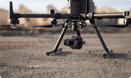
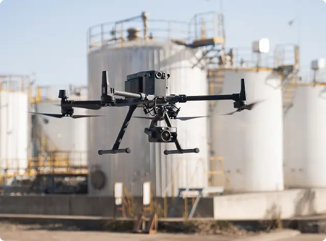
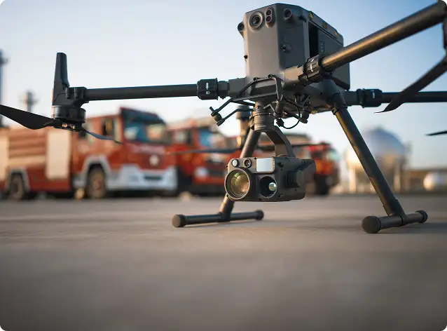
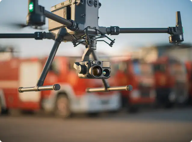
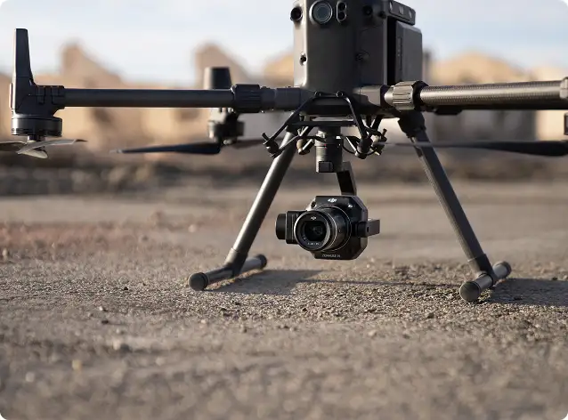
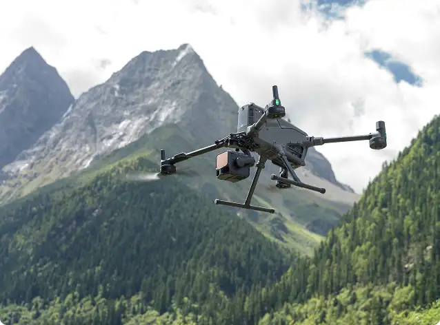
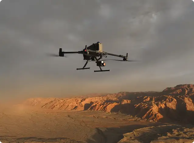
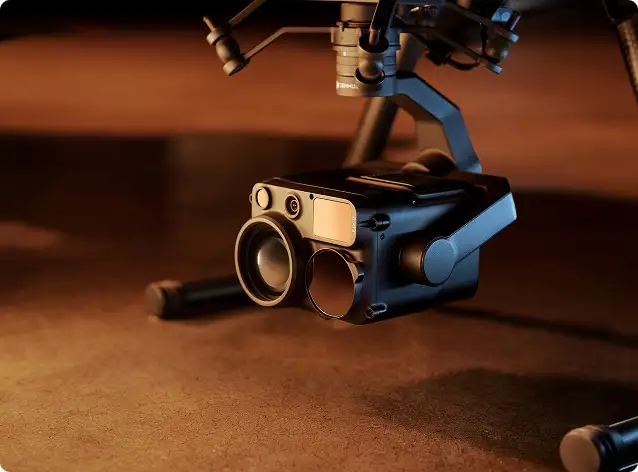
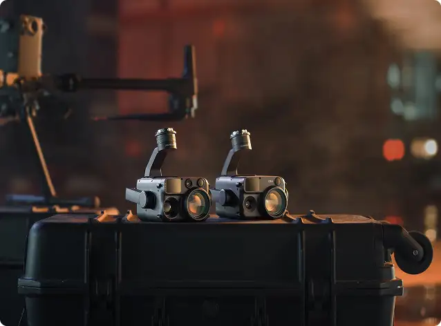
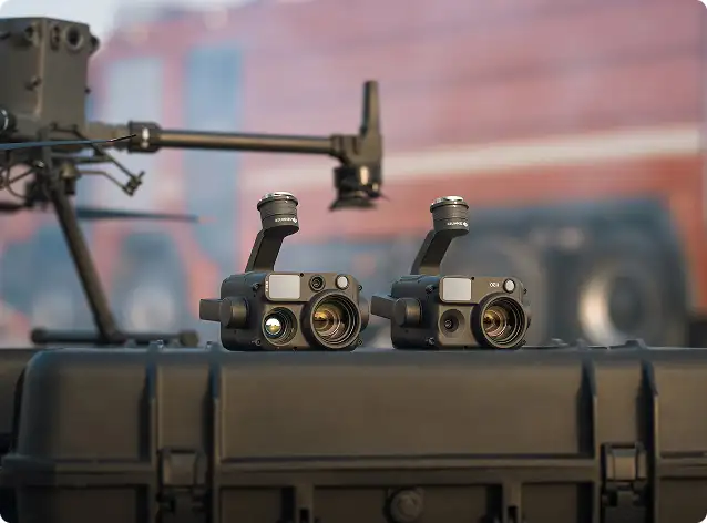
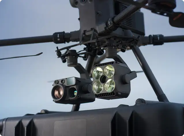
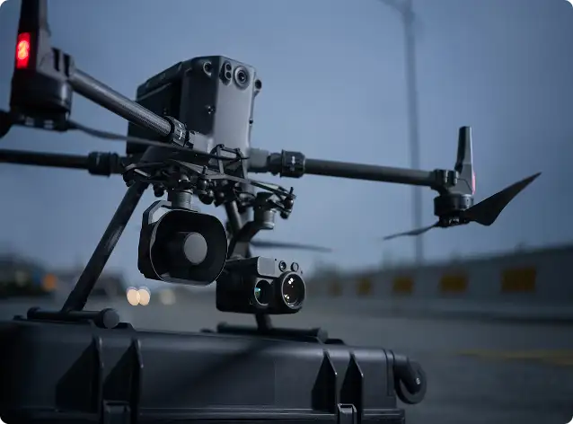
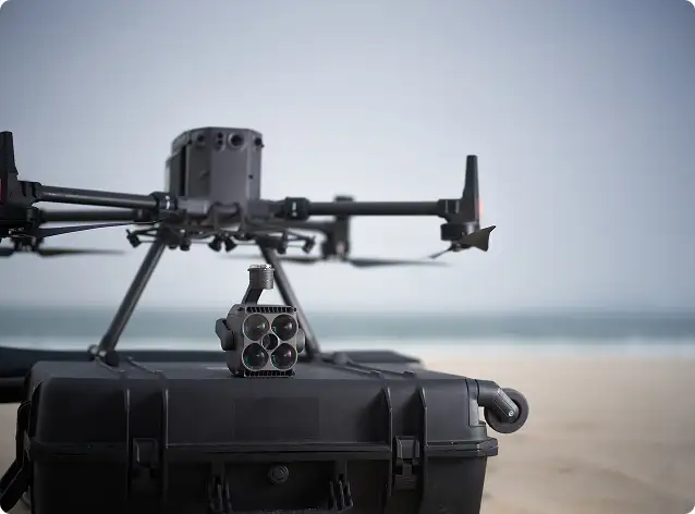
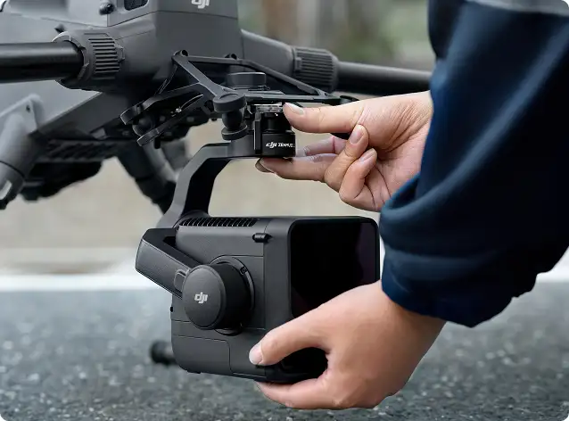
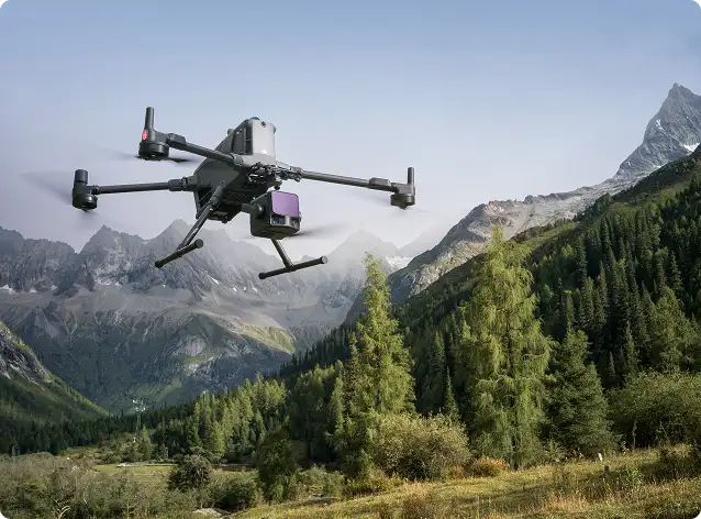
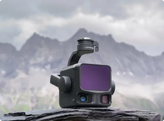
Combining advanced zoom optics, thermal imaging, and laser range capability, the H30 series delivers confidence in every mission.
With full-frame imaging and interchangeable lenses, the P1 delivers survey-grade accuracy with reduced flight time and higher coverage efficiency.
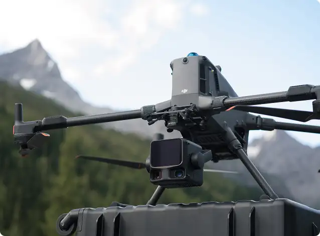
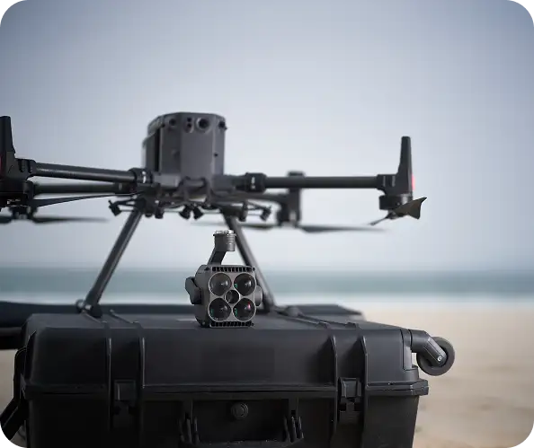
L2 delivers dense point clouds, accurate ground returns, and reliable surface models — even in challenging environments.
Trusted by smart city programs, planning authorities, and geospatial survey organizations, SHARE cameras reduce flight missions while maintaining data consistency and accuracy.
These systems integrate seamlessly into inspection workflows and enterprise safety programs.
Soarability sensor solutions support science-grade environmental intelligence across industrial and research missions.
These payloads provide accurate, regulatory-ready data for decision-makers and compliance teams.
We support advanced mission ecosystems powered by UgCS mission planning software and SPH Engineering integrated UAV solutions.
These platforms are trusted for underground utility mapping, archaeology, environmental research, and marine or inland water surveys.
We don’t just supply payloads — we help organizations achieve measurable operational outcomes.
Our objective is simple:
Better data. Less time. Higher confidence. Real business value.
Our Payload Cameras & Sensor Solutions are trusted across:
Every deployment is tailored to operational goals, regulatory environments, safety standards, and data requirements — because every mission and every dataset matters.
Surveying & geospatial engineering
Oil & gas, utilities & power networks
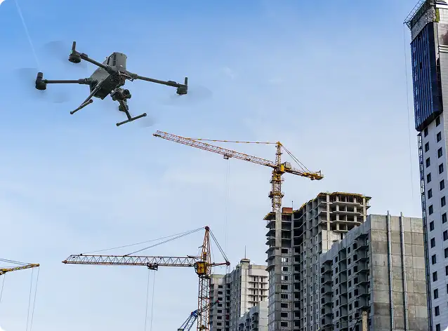
Industrial asset inspection
Smart cities & infrastructure monitoring
Public safety & emergency response
Environmental research & compliance
Defence & security applications
Whether you are launching a new drone program or expanding into automation and remote operations, our team will work closely with you to design a solution aligned with your mission, environment, and operational goals.
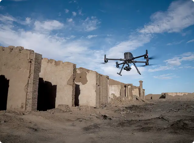
Gulfnet Emirates is a trusted supplier of drone payload and sensor cameras in UAE, offering the complete DJI Enterprise ecosystem along with specialized third-party solutions. The product range covers visual, zoom, thermal, LiDAR, and multispectral cameras suited for inspection, mapping, surveillance, and environmental monitoring. Businesses across Dubai, Abu Dhabi, and the wider Emirates can access payload consultation, procurement, and integration support tailored to their operational needs. Every solution is backed by professional onboarding and long-term technical assistance.
For industrial inspection across the Middle East, the DJI Zenmuse H30 series stands out as a top choice due to its combination of advanced zoom optics, thermal imaging, and laser ranging in a single platform. These drone cameras deliver stabilized, high-clarity imagery that helps teams identify defects, hotspots, and structural concerns in assets like pipelines, towers, and power networks. Gulfnet Emirates provides these payload systems with full mission planning guidance, ensuring reliable data capture that meets enterprise-grade quality standards across demanding field environments.
Yes, Gulfnet Emirates supplies industrial-grade gas detection sensors for drones across the UAE and GCC region. These payloads are designed to identify methane leaks and hazardous emissions at oil and gas facilities, pipeline corridors, refineries, and landfill sites. When paired with UgCS mission planning and SPH Engineering workflows, they support automated flight paths with geo-referenced data logging for compliance reporting. This approach allows teams to inspect hazardous zones remotely, reducing safety risks while producing accurate, regulatory-ready environmental data.
Absolutely. Our payload solutions integrate with photogrammetry platforms, GIS systems, inspection tools, and enterprise data pipelines. We ensure seamless adoption through structured workflows, automation, and onboarding support.
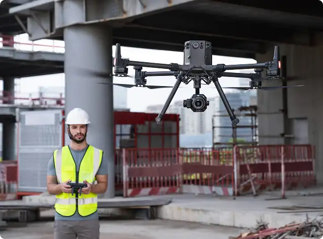
Gulfnet Emirates is a leading drone payload supplier for enterprise use in UAE, offering end-to-end support from product selection through deployment and ongoing maintenance. The company works closely with organizations to match the right cameras and sensors to specific industry applications, whether that involves inspection, mapping, security, or environmental monitoring. Beyond supplying hardware, the team provides operator training, workflow configuration, and long-term technical assistance to ensure each payload system continues delivering measurable value over its full lifecycle.
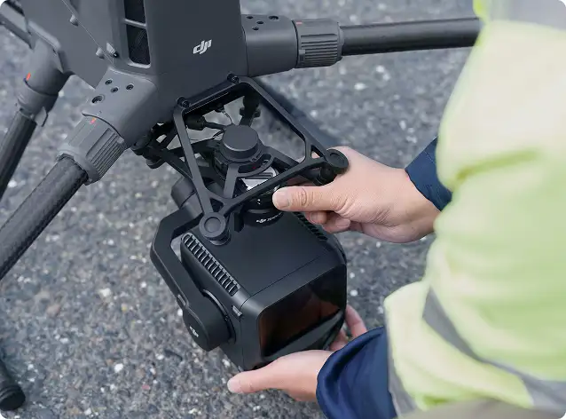
Gulfnet Emirates offers a range of thermal imaging cameras for drones across the GCC, including the DJI Zenmuse H30T, which integrates thermal sensing with visual zoom and laser range measurement in one compact platform. These cameras are widely used for electrical and mechanical inspections, building envelope assessments, and perimeter security operations. Thermal payloads detect temperature anomalies and hotspots that are invisible to the naked eye, making them essential for predictive maintenance workflows in power utilities, oil and gas, and large-scale industrial facilities throughout the Gulf region.
Gulfnet Emirates supplies LiDAR sensors and drone payloads in Dubai, featuring the DJI Zenmuse L2 as a core offering for terrain modeling, corridor mapping, and vegetation analysis. The L2 produces dense, accurate point clouds that support engineering design, mining volumetrics, and forestry surveys even in complex environments. Clients in Dubai also benefit from hands-on payload integration, operator training, and post-processing guidance to ensure that LiDAR data is captured correctly and translated into actionable surface models and digital terrain outputs.
Yes, Gulfnet Emirates provides multispectral cameras for agricultural drones in UAE as part of its enterprise payload portfolio. Multispectral sensors capture data across multiple light bands, allowing agronomists and farm managers to assess crop health, detect irrigation stress, and monitor vegetation indices with precision. These cameras are particularly valuable in the UAE’s arid farming environments, where early identification of plant stress can significantly reduce resource waste. Integration support and data processing guidance are included to help agricultural operations act on the insights these sensors deliver.
Gulfnet Emirates serves Abu Dhabi with high resolution drone cameras and sensors built for professional survey, inspection, and documentation missions. The DJI Zenmuse P1 offers full-frame imaging with interchangeable lenses for photogrammetry-grade accuracy, while SHARE aerial survey cameras handle large-area oblique and orthomosaic capture. These solutions are trusted by engineering firms, government agencies, and smart city programs that require sharp, consistent imagery for digital twins, cadastral surveys, and infrastructure monitoring throughout the Abu Dhabi region.