Modern Farming Needs Sharper Visibility

Agricultural operations throughout the GCC are faced with unique pressures such as water scarcity, shifting soil conditions and growing cultivation footprints. Ground-based monitoring is a difficult task to achieve the necessary spatial resolution and response speed required by precision farming.

scale-terrain
Scale & Terrain

Expansive fields and remote plots limit effective coverage through manual methods.

invisible-corp-stress
Invisible Crop Stress

Nutrient deficiency, pest pressure, and water imbalance are hard to spot with manual inspection methods.

agriculture-challanges
input-waste
Input Waste

Manual methods are incapable of ensuring uniform application, leading to overuse, higher costs, and environmental burden.

disconnected-records
Disconnected Records

Manual inspection leads to scattered crop data, which limits traceability and informed agronomic decisions.

Our Drone Services for Agriculture

Gulfnet offers certified operations supporting crop intelligence and sustainable land management through unmatched drone services.

multispectral-survey

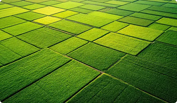
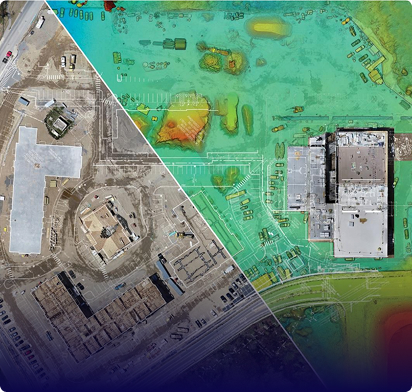
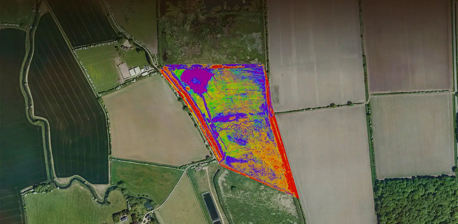
Multispectral Crop Survey

We offer pre-planned UAV flights that capture reflectance data across visible and near-infrared bands, generating vegetation indices that reveal crop vigor and stress patterns.

  • NDVI and NDRE index maps generated 
  • Early stress detection before visible symptoms
  • Irrigation and nutrient assessment supported
  • Geo-referenced datasets for agronomic planning
precision-drone-spraying

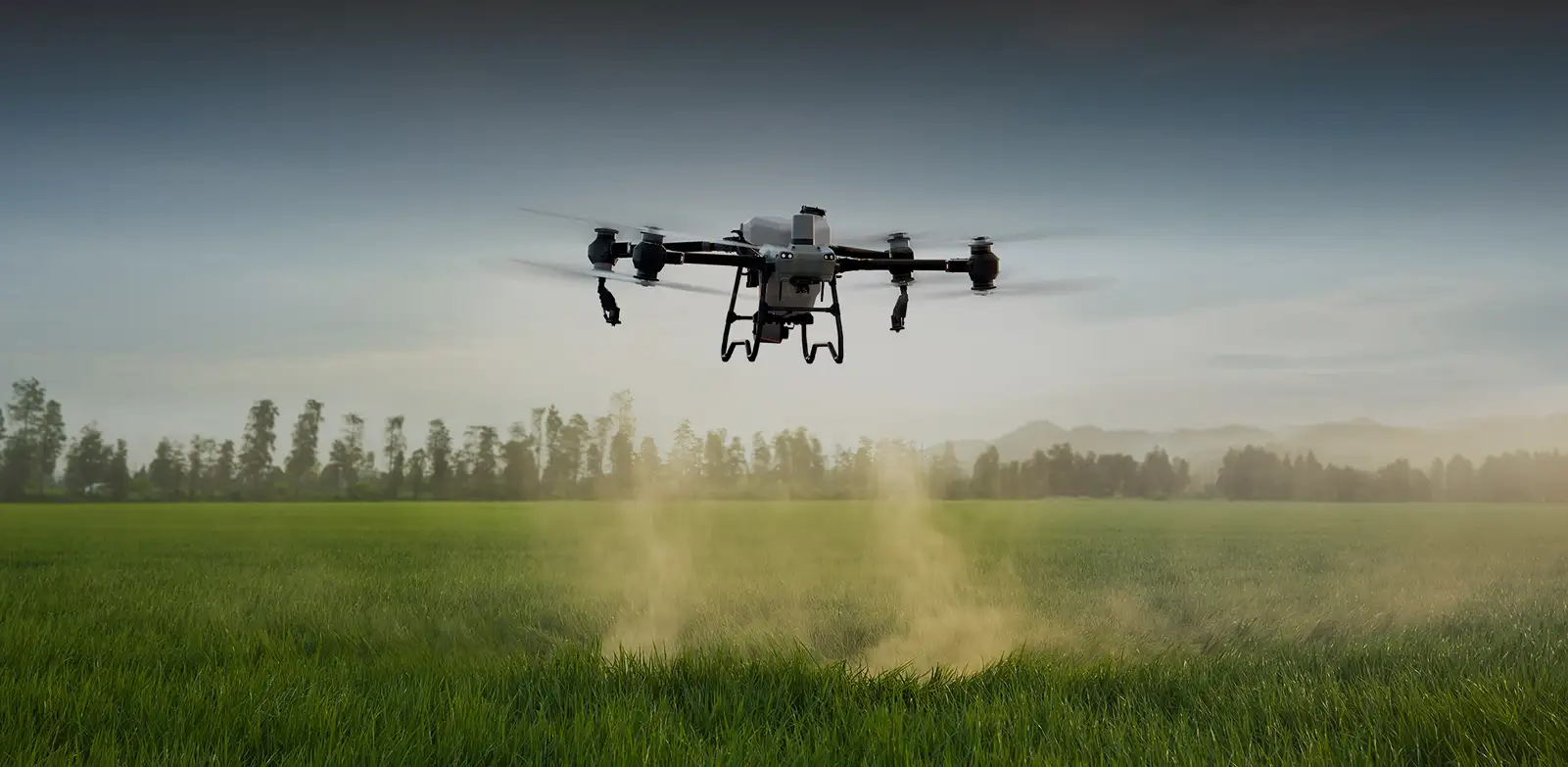
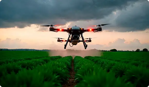
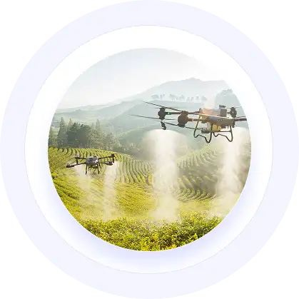
Precision Drone Spraying

Our low-altitude UAV missions deliver calibrated pesticide, herbicide, or fertilizer applications with variable-rate control based on prescription maps and field conditions.

  • Targeted coverage reduces chemical volume used 
  • Worker exposure to spray chemicals minimized
  • Difficult terrain and standing crops accessible 
  • Application logs with geo-referenced documentation
speed-dropping

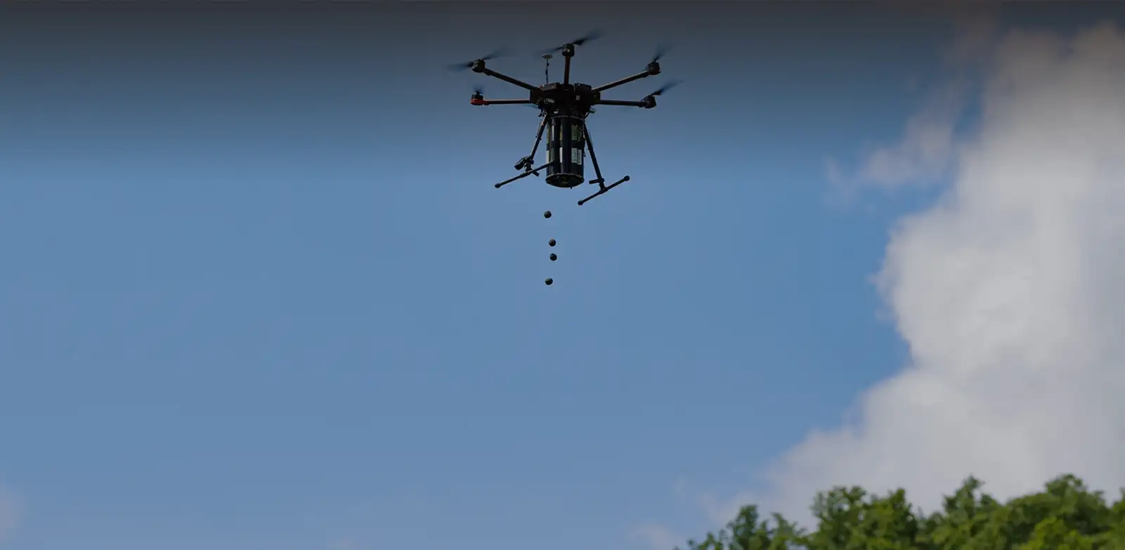
Seed Dropping & Restoration

Through controlled aerial seed dispersal, we support reforestation, mangrove restoration, and soil stabilization programs across hard-to-access or environmentally sensitive terrain.

  • Drop rates adjusted to terrain conditions
  • Coverage maps with GPS-tagged records
  • Coverage maps with GPS-tagged records
  • Access to remote and protected areas
land-and-soil

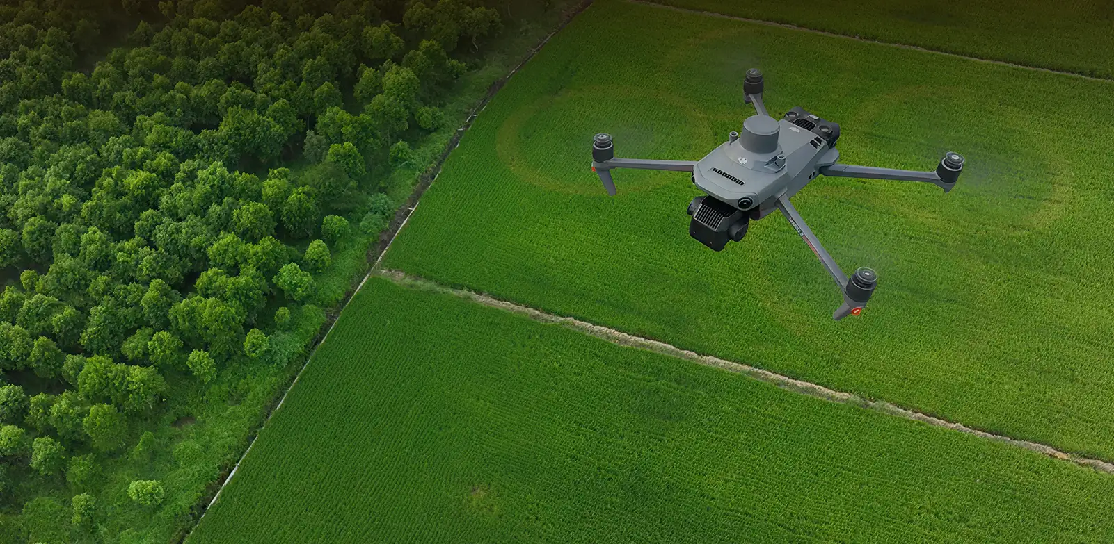
Land & Soil Assessment

Our drones provide clear aerial imagery and sensor data to capture terrain variability, drainage patterns, and soil condition indicators to support planting and irrigation planning.

  • Topographic variability mapped across holdings
  • Drainage and water accumulation patterns identified 
  • Inputs for land-use and zoning decisions
  • Baseline datasets for seasonal comparison

Gulfnet Insight® - Field Data That Drives Decisions

Your centralized platform for reviewing vegetation indices, tracking field conditions, and planning interventions.

NDVI and stress maps are visualized together.
Array

Application coverage logged with coordinates.
Array

Historical comparison across growth cycles.
Array

Exportable datasets for farm management systems.
Array
index-layers

Aging assets won't wait - schedule your agricultural monitoring and application requirements now.

Other Industries

Frequently Asked Questions

Drones equipped with multispectral and NDVI sensors are widely used for crop health monitoring in UAE farms. These UAVs fly pre-planned routes over fields and capture reflectance data across visible and near-infrared bands, generating vegetation index maps that reveal plant vigor, nutrient gaps, water stress, and early signs of pest damage. By identifying these issues well before they become visible to the naked eye, farm managers can take corrective action faster and reduce crop loss. Gulfnet provides geo-referenced survey outputs that pinpoint affected zones with GPS accuracy for targeted treatment.

Gulfnet offers professional drone spraying services for farms in Dubai and Abu Dhabi, covering pesticide, herbicide, and fertilizer application through low-altitude UAV missions. These drones use variable-rate technology guided by prescription maps to apply the right dosage across each section of a field. Aerial spraying reaches difficult terrain and standing crops that ground equipment cannot access without causing damage. It also reduces chemical drift, cuts overall input usage, and keeps workers away from direct spray exposure, making it a safer and more efficient alternative to traditional methods.

Yes. Drone based seed dropping is being used increasingly for reforestation, mangrove restoration and soil stabilization projects in the region. UAVs with controlled dispersal mechanisms have the potential to reach remote, difficult or environmentally sensitive terrain that cannot be efficiently reached by manual planting methods. Flight parameters and drop rates are modified depending on terrain conditions and restoration objectives. This technique is used to support afforestation programmes, wetland rehabilitation and erosion control programmes, and also with geo-tagged documentation of the coverage for project reporting and progress tracking.

Gulfnet provides drone-based irrigation and farm mapping services in UAE that help farmers understand their land at a level manual surveys simply cannot match. Our UAVs capture high-resolution aerial imagery and sensor data to generate topographic maps, identify drainage patterns, and highlight water accumulation zones across a property. These outputs feed directly into irrigation planning by showing exactly where water reaches and where it does not. Farm managers also receive orthomosaic maps and geo-referenced datasets through Gulfnet Insight, enabling seasonal comparisons and smarter resource allocation over time.

Gulfnet Emirates is a trusted agricultural drone company serving large farms across the GCC with certified drone operations and scalable service capacity. Our automated flight missions cover expansive fields quickly, whether the task involves multispectral crop surveys or precision spraying over hundreds of hectares. Each project is planned around the specific size, terrain, and crop requirements of the farm, with realistic timelines and coverage commitments agreed upon before deployment. From pre-season land assessment to in-season monitoring and post-harvest documentation, Gulfnet delivers end-to-end agricultural drone support for large-scale operations.

All operations are executed in compliance with applicable aviation authority requirements across the GCC, including GCAA and GACA regulations. Agricultural applications follow established crop safety guidelines, dosage protocols, and drift-control practices. Environmental restoration missions adhere to applicable land management and conservation standards. Regulatory compliance, including permit acquisition where required, is managed as part of our standard project delivery process.

Gulfnet offers a comprehensive range of agriculture drone services for farms in UAE, including multispectral crop surveys, precision spraying, seed dropping, and land assessment. Each service is designed to address specific farming challenges such as early detection of crop stress, targeted chemical application, reforestation support, and terrain mapping. Our operations are fully certified and comply with GCAA regulations. Whether a farm needs a one-time aerial survey or ongoing seasonal monitoring, Gulfnet tailors its drone services to fit the scale and crop type of the operation.

Drone-based crop monitoring and spraying in the GCC combines two core UAV capabilities into a connected workflow. First, multispectral sensors on the drone capture vegetation index data during a survey flight, identifying areas with nutrient deficiency, water stress, or pest pressure. That data is then used to generate prescription maps, which guide a follow-up spraying mission with variable-rate application. This approach ensures chemicals are applied only where needed, reducing waste and improving crop outcomes. Gulfnet manages both stages as a single coordinated service across GCC agricultural operations.

Gulfnet supplies and operates a range of precision farming drones available in UAE, including DJI Agras series models built specifically for agricultural applications. These UAVs are equipped with multispectral cameras, NDVI sensors, and variable-rate spray systems that support everything from crop health surveys to targeted pesticide delivery. Each drone platform is selected based on the size of the farm, the type of crop, and the specific service required. Gulfnet also provides training, data processing software, and integration support through its Gulfnet Insight platform for ongoing field intelligence.

The best drone solutions for agriculture in the Middle East combine multispectral imaging, precision spraying, and data analytics into a single service offering. Gulfnet delivers exactly this through its certified agricultural drone operations, addressing regional challenges like water scarcity, arid terrain, and large cultivation footprints. Their solutions include NDVI-based crop monitoring, GPS-guided chemical application, aerial seed dispersal, and detailed land mapping. All outputs are accessible through the Gulfnet Insight platform, giving farm managers a centralized view of field health, spray records, and seasonal trends.

Share your asset list and inspection priorities
to receive a tailored scope and plan.

Request our capabilities deck and platform walkthrough to see reporting and workflows.